1
/
of
9
Chevron Corp
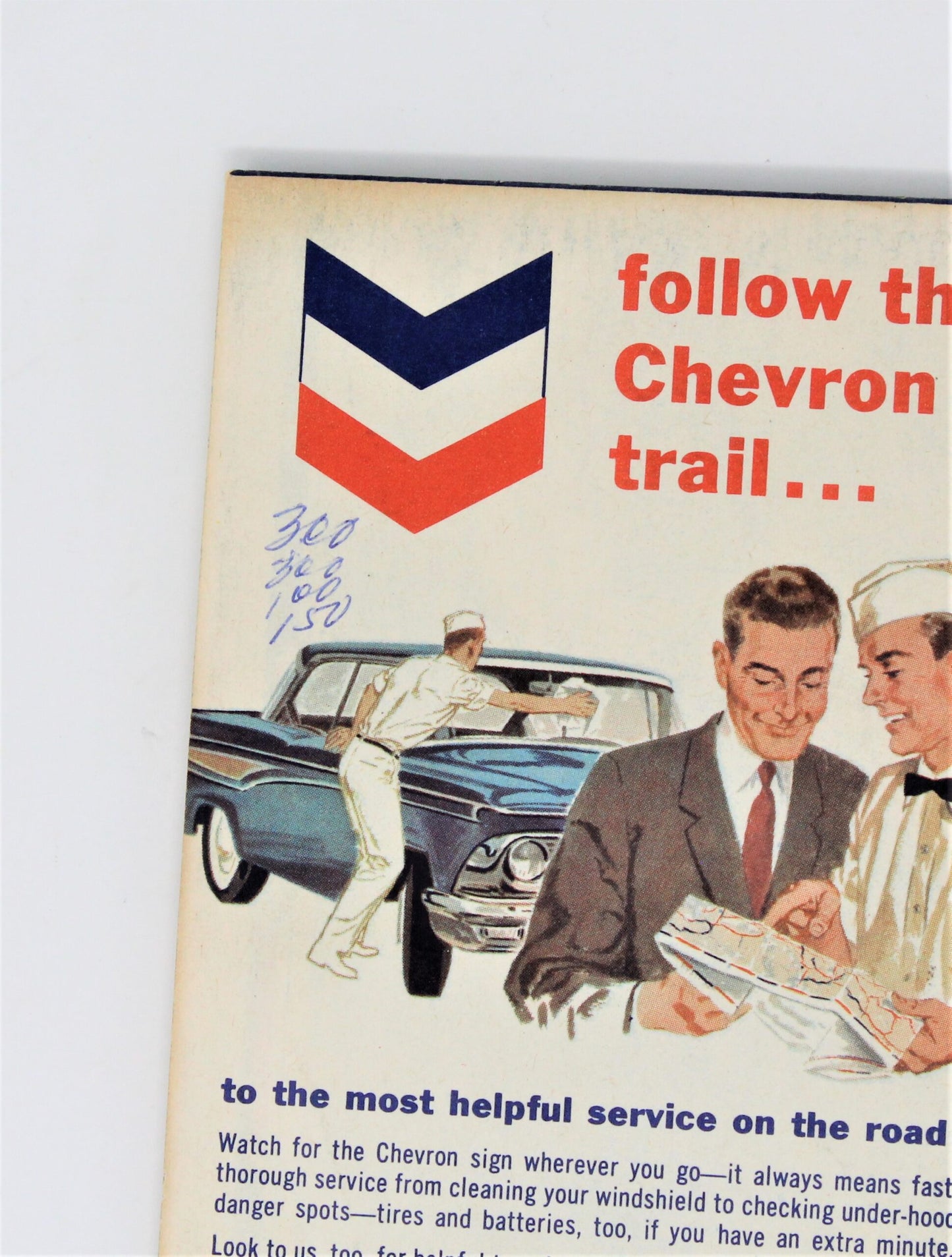
Road Map, Chevron Gousha Lithograph, Nevada, Vintage 1959, SOLD
Road Map, Chevron Gousha Lithograph, Nevada, Vintage 1959, SOLD
Regular price
$0.00
Regular price
Sale price
$0.00
Shipping calculated at checkout.
Quantity
Couldn't load pickup availability
- Vintage Road Map, Oil & Gas Advertising, Chevron, Nevada Charleston Peak Area, Service Station Promotional Products, Travel Ephemera, (Discontinued)
- Made in USA
- Vintage: Copyright 1959
- Details: This is such a beautiful map, and hard to find! Made by the H.M. Gousha Company, Chicago, it has several illustrations on areas of interest in Nevada. On the cover, the lithograph depicts the Charleston Peak area, with several people on horseback surrounded by pine trees and Charleston Peak in the background. Inside it has illustrations for: Humboldt River, Pyramid Lake, Ruby Mountains, Lake Tahoe, Lake Mead and many others. Truly a map to be treasured, it is from what is known as the "Silver Age" of automobile maps because this period of maps has the most beautiful scenes, bright colors and great graphics. This map is the perfect gift for a collector, whether collecting for nostalgia, great illustrations, a gas station collection, local history, map makers, or memories of a visited/lived-in destination, there are many reasons to start or continue this great and relatively inexpensive hobby. If this is your hobby, we hope this map brings you joy. Great going away present for someone moving to or leaving the state of Nevada.
- Material: Paper
- Dimensions: 9" by 4" Folded
- Condition: Vintage - Used. Good Vintage Condition. The paper is yellowing but this is consistent with its age. There are some tears, two on the front cover, and one inside on a fold-line. Please review all pictures and make sure you love this item before purchasing, we can't accept returns. Please remember these are VINTAGE and ANTIQUE items, every effort has been made to show any scratches, wear and tear and imperfections.
H.M. Gousha Company was started by Harry Mathias Gousha. Harry was a salesman for Rand McNally but decided to leave the company in 1926 to start his own map company in Chicago, IL. The company became one of the "Big Three" major producers of road maps and atlases in the United States during the 25 years following World War II, making maps for oil companies and auto clubs and coming a very big competitor of his previous employer, Rand McNally. The company relocated to San Jose, CA in 1947. They were acquired by the Times Mirror Company in 1961, and then Simon & Schuster in 1987. Ironically being acquired by Rand McNally in 1996.
Share